The End (For Now)

9/3 - Spokane, WA - Mile 2,300
Well this is it – I'm officially "off trail," as hikers say. After four months and change of hiking, I'm back in Spokane, writing this from my couch.
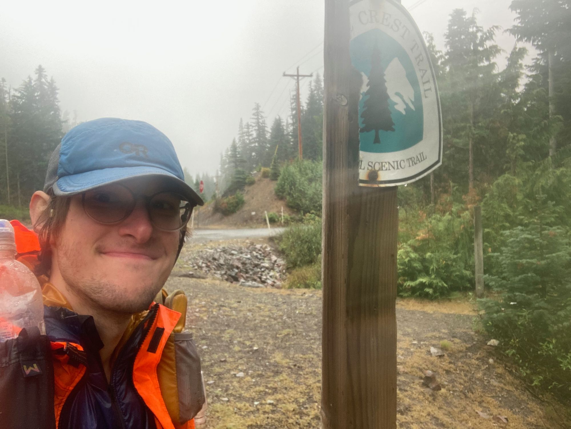
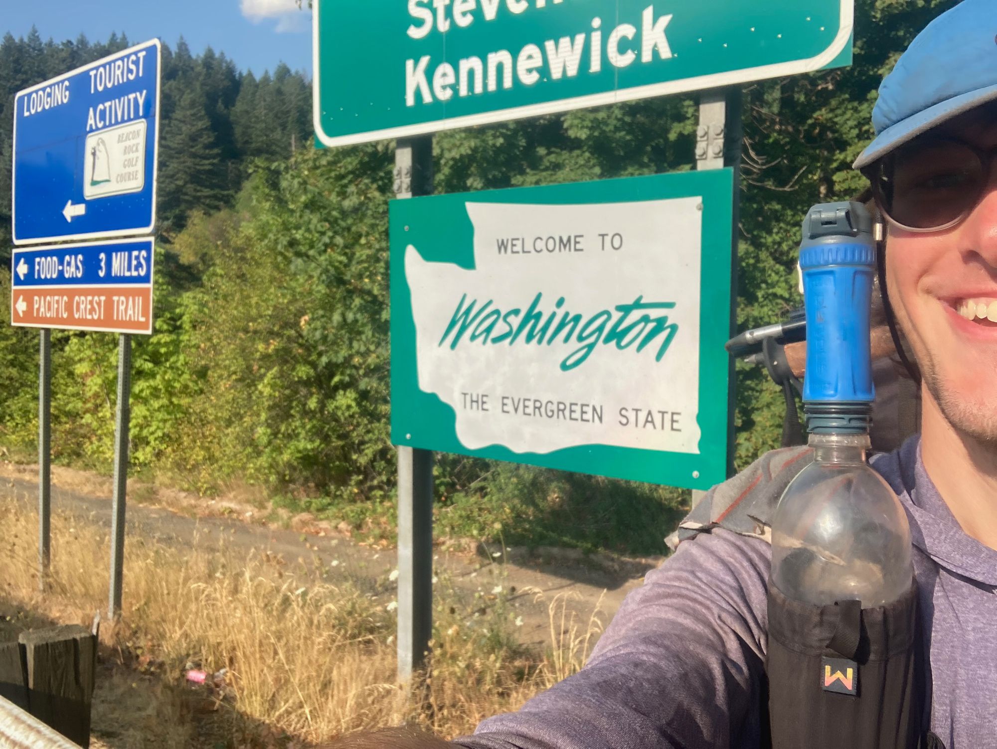
The comfort of being home is a stark contrast from the last few days of my journey. Hiking over the Bridge of the Gods into Washington was routine enough, as was the trail afterwords. It was, however, almost immediately clear that the state would be a very different beast than Oregon – I'd spent weeks doing 5,000 feet of elevation gain over the course of 35-40 mile days. The trail out of Cascade Locks, by contrast, made me do almost that much climbing in just over 15 miles, and there were several more climbs of a similar caliber before the first Washington trail town, Trout Lake.
That was something I was prepared for, though – after all, I'd made it through Northern California, which felt like it was almost exclusively steep climbs and descents. In fact, I was in pretty high spirits as I reached the Trout Lake general store, and my morale improved even more when I discovered what a lovely place it is. It's run by a family that lets hikers stay in their yard, and they provide pretty much all the amenties you could need; showers, a washer and dryer for doing laundry, and, of course, food to get you through to the next resupply point at White Pass.
I also got to meet several friends there; some that I'd gotten acquainted with way back in the desert, and some that I'd met in the past few days of hiking. (We all hung out at the local taco truck, which was doing a free dinner as part of its last day ever being in business – apparently I'd made it at the perfect time.) Leaving town, though, I got my first sign that things weren't going to be as easy as I thought. For most of the morning, I was hiking through rain. It'd been raining the day I went into Trout Lake, too, though that was less of a concern; drying your gear out in town is pretty easy, but doing it on trail can be more difficult, especially if it doesn't stop raining.
Anyways, it didn't really stop raining. There was a bit of sun in the afternoon of my first day out of town, but when I woke up the next morning, I realized that I'd be hiking all day in the rain. The temperatures had also plummeted. On my hike out of Cascade Locks, it was over 90 degrees out; now, the highs were in the mid 50s.
Of course, I have gear for dealing with both cold and rain. Having to deal with both together for a sustained period of time, however, is a different beast. Usually, I don't have to wear my jacket when I'm not at camp; hiking is enough to keep me warm. But with temperatures in the 40s and a constant drizzle of cold rain, I found myself shivering even when climbing uphill, and my hands were painfully numb for almost the entire day. Still, I figured it'd be okay; my Garmin told me the next day would be sunny, I'd be able to warm up when I made it to camp. I'd specifically left my insulated jacket in a protective bag in my backpack, even though wearing it would've made hiking a bit less miserable. That way, I thought, it'd be dry enough to keep me warm overnight.
But it turns out that my pack liner has a few holes in it. After setting up my tent Thursday evening, I discovered that everything was soaked – including my puffy jacket and quilt. That made sleeping a mostly futile exercise in misery; the past few days had also had overnight temperatures in the 40s, and I'd been just warm enough when all my stuff was dry. With all my gear in various stages of wetness from damp to soaked, I spent more time awake and shivering than I did resting and recovering after hiking 30 miles through the mountains.
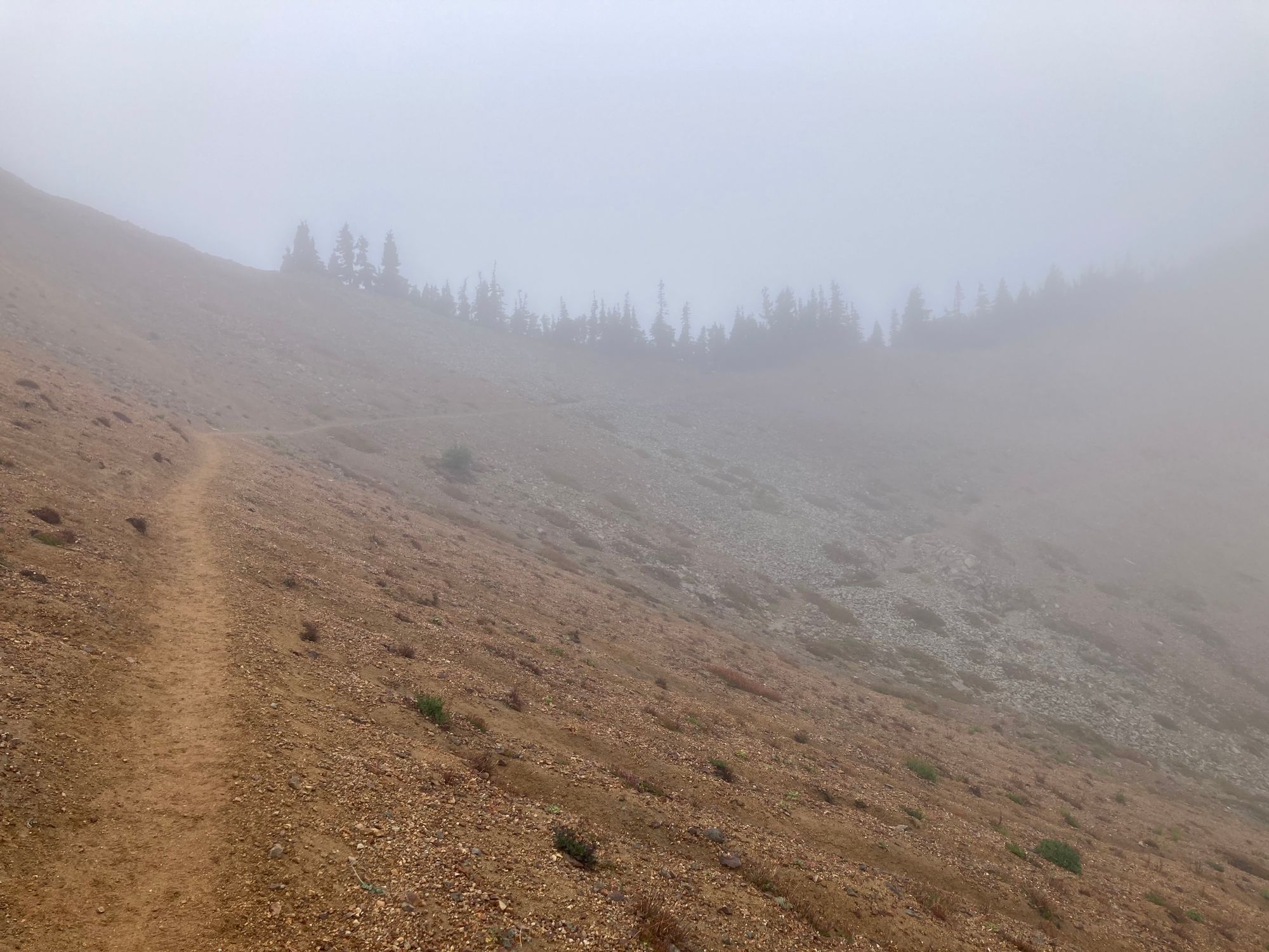
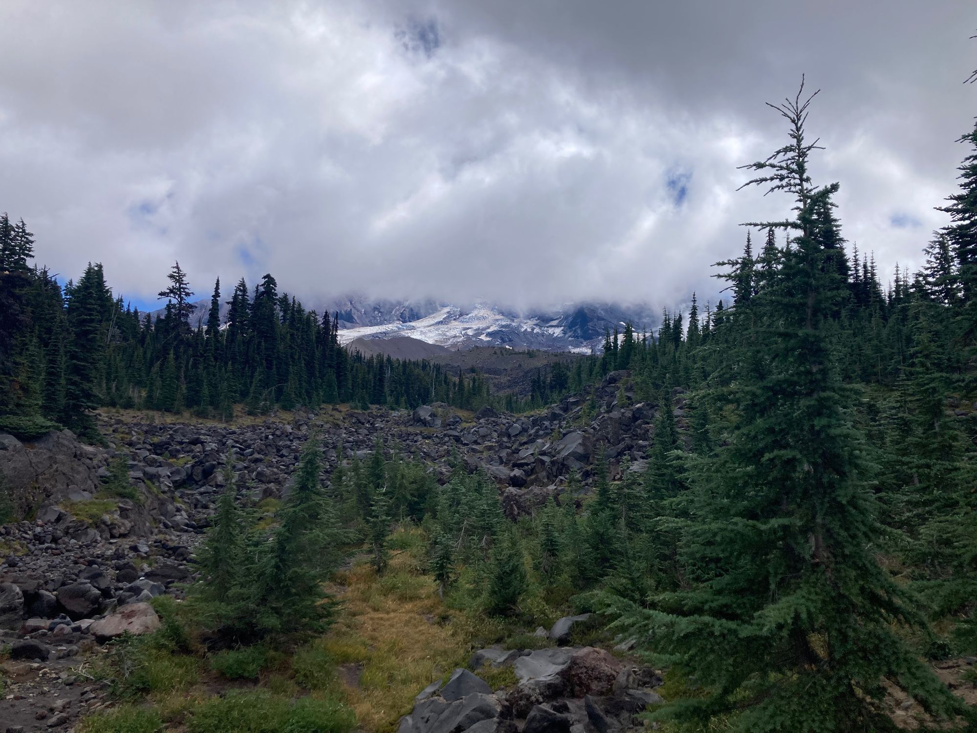
The scenery didn't help lift my spirits much. For weeks people who'd already hiked through Washington had been telling me that I was about to reach some of the best parts of the trail, including a famous landmark called The Knife's Edge. Hiking it involves walking along an extremely exposed ridge, with thousand-foot drop-offs on either side. Obviously, it's a little scary, but the reward is getting to see for miles in every direction, getting views of mountains like Rainier and St. Helens.
This is what I saw:
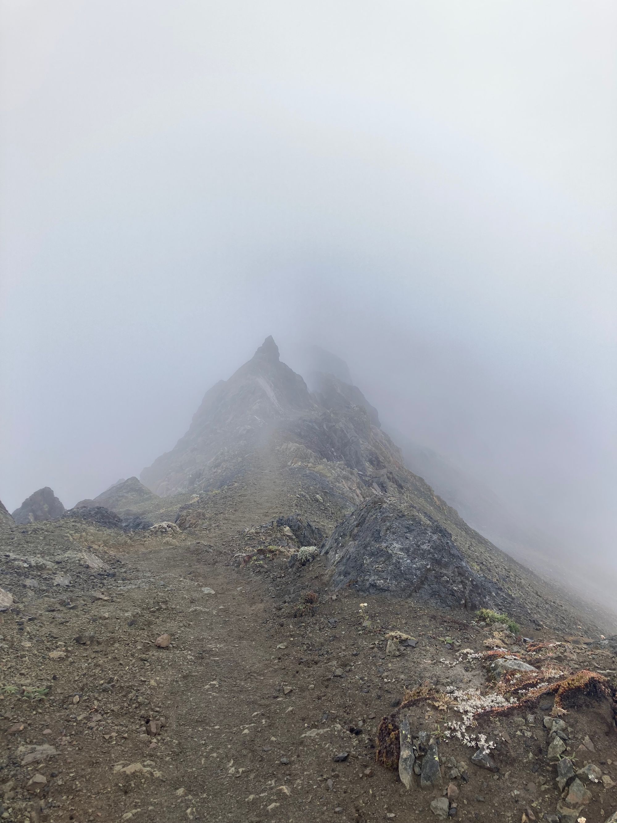
To be clear, it was still an interesting experience; I got to watch the narrow trail and the crags around it appear out of the fog around three feet in front of me. (I promise it's not as scary as it sounds.) But I'd be lying if I said I wasn't disappointed; I was expecting to see mountains, and yet even when I was walking at the very foot of Mt. Adams I could only catch a few glimpses of it through the clouds. For almost three days of hiking, the views were mostly limited to an impenatrable bank of grey cloud that limited visibility to less than 10 feet. I don't think it'd make a great postcard.
Making matters worse, Friday morning brought more rain, instead of the sun that was forecasted. After a few wet miles of hiking, I reached White Pass where I was able to use the internet to see if there was any chance of conditions improving. Reports were conflicting; some said the rain was due to clear up at any second, while others said it would continue for a few more days, and that I could also expect some thunderstorms to boot.
I was at an impass, and the information I was getting made it hard to decide what to do – if the weather was good, I could dry my gear and clothes, then continue on for a relatively easy week or so of hiking to Leavenworth, as I'd originally planned. If it was bad, though, it'd be almost 100 miles until the next bail-out point... and you can suffer a lot in "only" 100 miles.
So I decided to play it safe, and asked Becky to come pick me up. In some ways, it was the obvious choice; most of the PCT trailheads in Washington are less than five hours away from my house, so it won't be particularly difficult to come back and resume my trip in the future. Also, if the foul weather continued, I'd risk mising out on what I've been told are some of the best views on the trail. That's a big potential downside, and the upside to continuing was... what, exactly? Getting to say that I hiked 2,300 or 2,2000 miles in 2023, rather than the 2,000 that stopping at White Pass left me with?
And yet the decision wasn't easy. I discovered that planning to stop hiking at some point in the future and actually getting off the trail two very different experiences. The former is theoretical; I could tell myself that, yeah, I probably wasn't going to finish at the Candian border, but I could still hold out a sliver of hope as long as I was still actually hiking north. Going home, however, is concrete. The hike is over now, if I go back it'll be the start of a new journey, not the completion of an old one.
Still, I think going home was the right choice. And, as you may have guessed, I do plan on going back at some point in the future. After all, there are still around 600 miles that I've left unhiked. That's why, I'm happy to announce, I'll be doing this all again next year! Starting from the border and working my way up, redoing the whole trail, along with the sections I didn't get to.
...
Okay, I'm just kidding.
My actual plan is to do the parts I missed in chunks, when I have time – I'll likely end up splitting up the rest of Washington into a few one-to-two-week trips throughout next year. Honestly, it'll probably be more enjoyable doing it that way, since I'll be able to pack real food from home, and will have the luxury of choosing perfect weather windows to hike in, rather than being at nature's mercy.
As for the Sierras, those are a bit trickier. Like with Washington, I have an approximately 300-mile stretch left, but it's in central California instead of my back yard. That means it'll probably be best to do it all in one shot, which will obviously take a bit. I haven't decided when I'm going to attempt that yet, though it'll obviously depend a lot on whatever job I wind up getting.
Finding said job makes up the bulk of my post-trail plans. I know a lot of people struggle after finishing or getting off the PCT, having lost that sense of purpose and drive that they've been keeping up for so long. I can't say I'm too worried about that though; rebooting my carrer should act as a big enough goal to keep me satisfied... and if it doesn't, I'm also planning another big physical endeavor. As soon as I have feeling in my toes again (they started going numb around Lone Pine, late June-ish), I'm going to start training to run a marathon in the hopes of completing one next fall.
Yes, I am aware that I've historically had an anti-running stance, but I think hiking so far at a relatively slow 3 MPH pace may have changed that. There were so many times where I wished I could just ditch the pack and start running (or jogging, at the very least), so I could get in more miles while still getting to soak in some scenery. Also, am I just supposed to let all this leg strength and stamina that I've built up for the past four months go to waste?
If the marathon goes well, I may ever consider going further. The Cascade Crest 100, which shares some miles with the PCT, seems like it'd be a very cool experience. I don't think I'll be sending any emails about the training process – I suspect it'll be substantially more boring than a trek across the US – but I'll be sure to let y'all know if I do end up actaully completing this goal.
On the subject of these posts, I'd like to thank everyone for reading along the past few months, and for the words of encouragement. The journey may not have ended exactly the way I planned at the start, but hiking the PCT is more than just touching the monuments at the Mexican and Canadian borders. While I'm definitely looking forward to making it to the northern terminus some day, I think all the stuff that came before it will be what really sticks with me; the friends I made, the awesome scenery that dotted the entire trail, and all the people who helped me along my journey by generously providing food, rides to town, and other aid that made the trip easier. That's the stuff that made the trail a worthwhile journey, no matter where it ended.