The Flip

7/01 - South Lake Tahoe - Mile 1093 (Kind of)
After two months of hiking in the desert, it'll be fun to face a new type of challenge... we're planning to reach Bishop, CA at some point next week, so you can look forward to a new report then!
Ah, me of a few weeks ago -- so full of optimism and confidence. Around five days later, I'd be back in Lone Pine, having turned back about 17 miles in.
There were signs that the section wouldn't go as planned early on. Shortly after we had finished the long climb up from Cottonwood Pass to rejoin the PCT proper, we met a big group of people heading the opposite way. They told us they'd made it around 11 miles before meeting a ranger that updated them on the conditions of Forester Pass. The report wasn't good -- they were told there was an ice chute on it, with no boot path across it that would make a traverse easier and safer. What's more, a ranger that had visited the pass said he wasn't able to get his ice axe into the ground at all, meaning that you'd have nothing to stop you if you fell and started sliding.
This news was, to put it lightly, kind of a bummer to hear. We weren't ready to give up yet, though. We figured we'd go and talk to the ranger ourselves, and potentially even go up to the pass so we could see what conditions were like with our own eyes. We all agreed there was no way we'd attempt crossing the pass if it were anything like the ranger said, but who knew? Maybe conditions would change by the time we got there.
Spoiler alert: they would not. And we would end up passing over a dozen more people who had turned around.
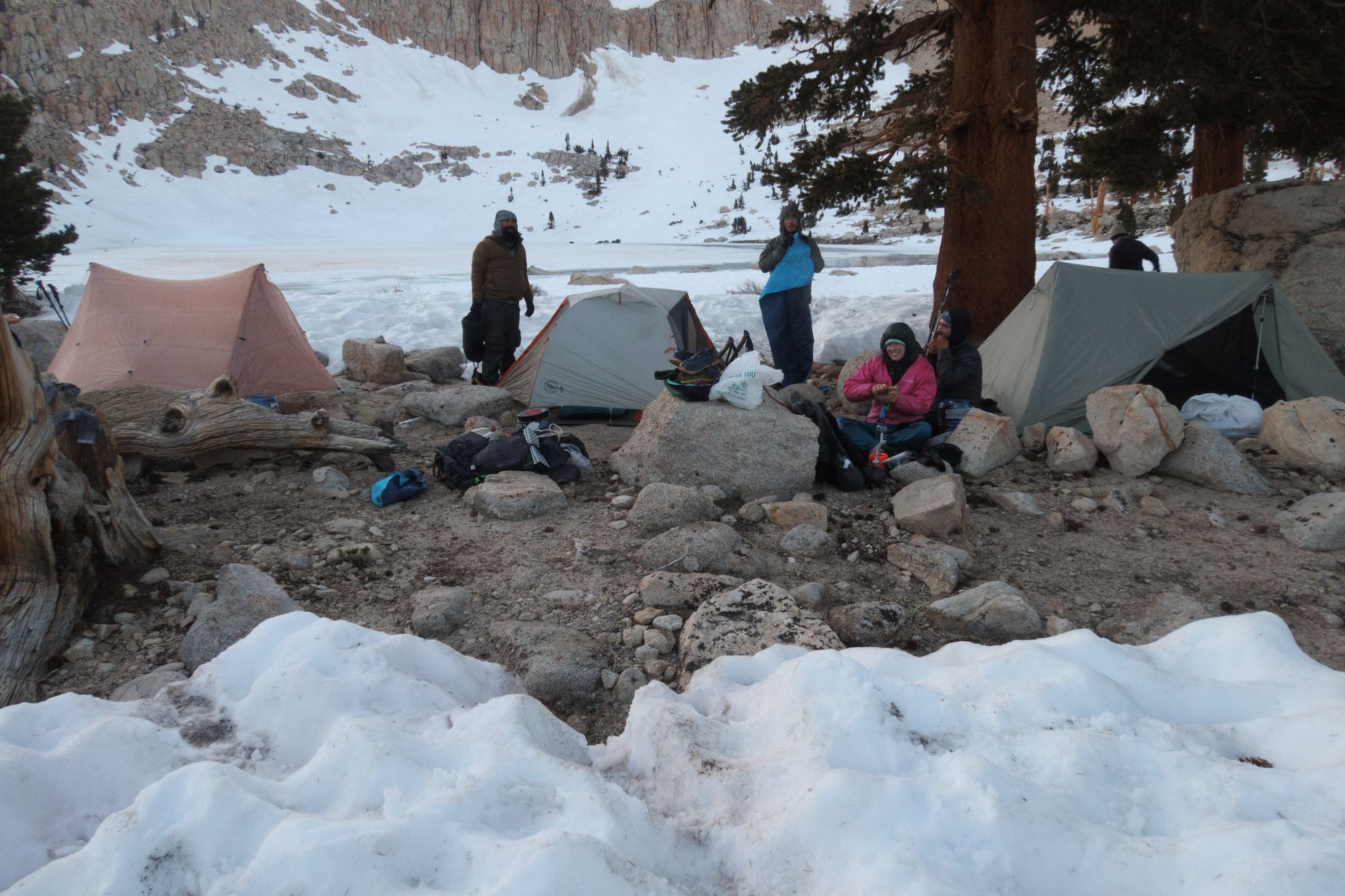
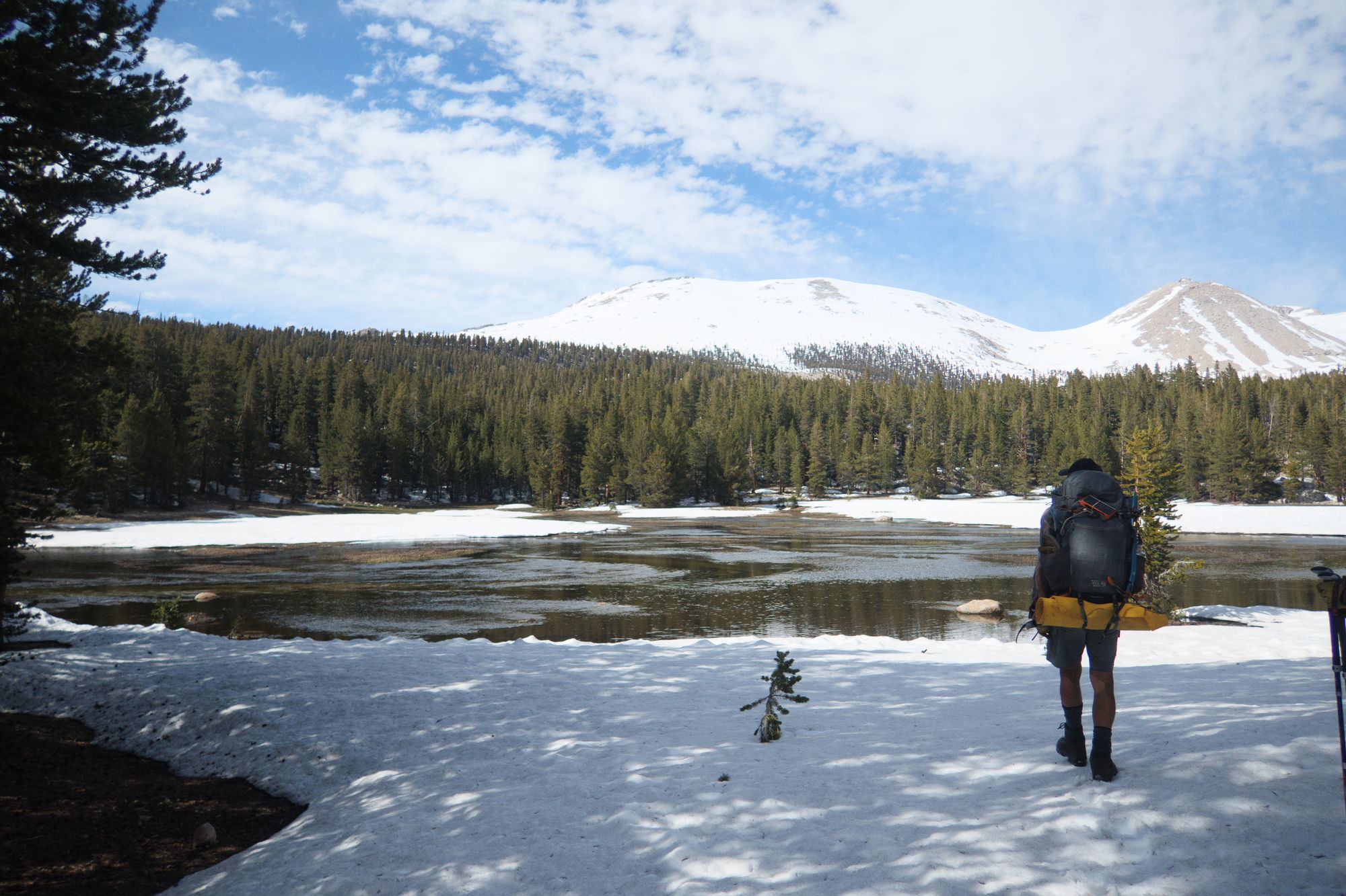
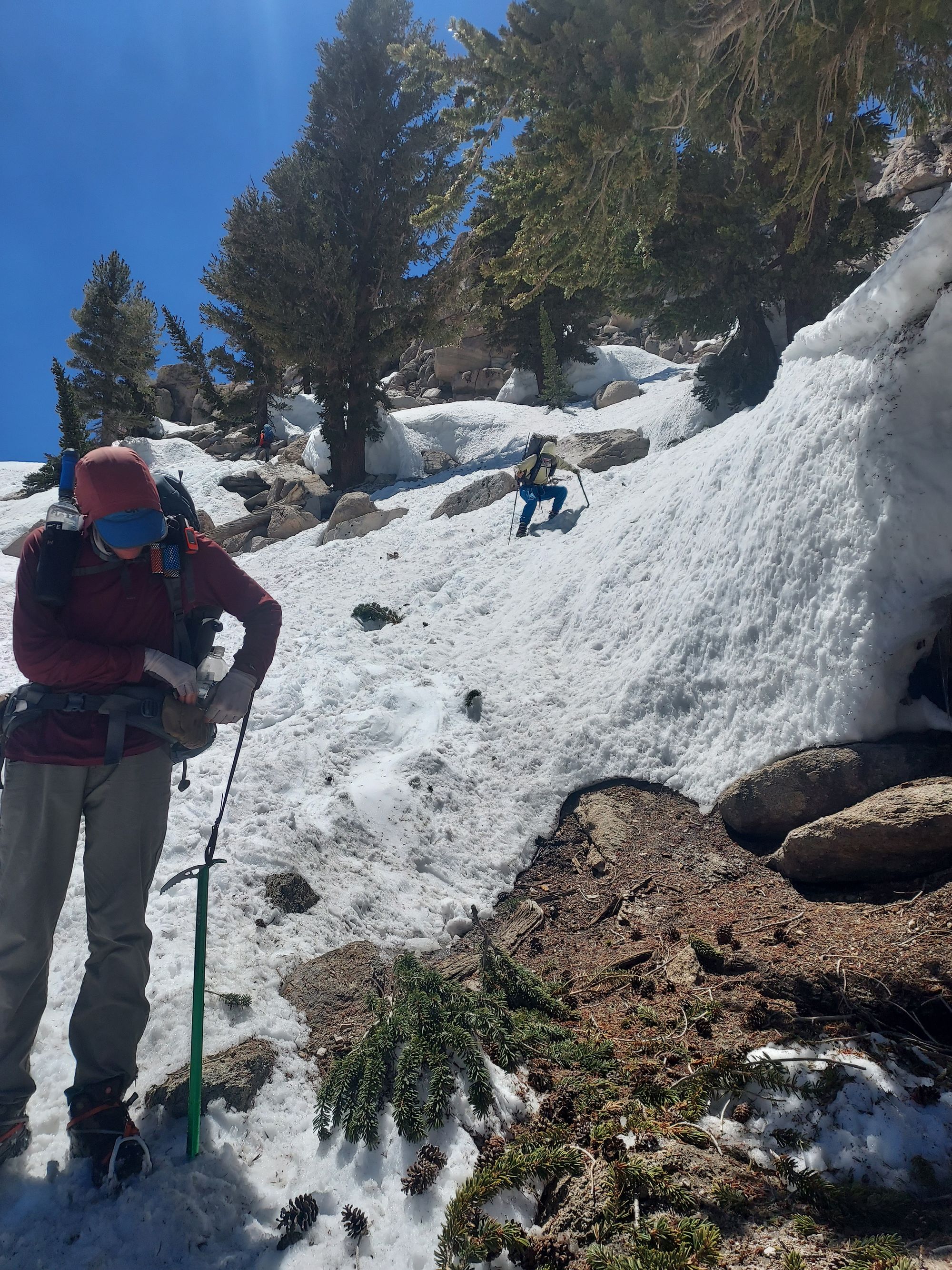
The hike to the ranger's station was extremely demanding, thanks to all the snow. Even when we woke up and started hiking hours earlier than normal, we were only able to do a maximum of 12 miles a day. Part of that was down to plain old getting lost. 99% of the time, the trail was completely covered by snow, which made it rather difficult to follow. There were boot tracks from other people who came through, but they were easy to lose, and often veered off in directions that seemed completely incorrect according to our maps.
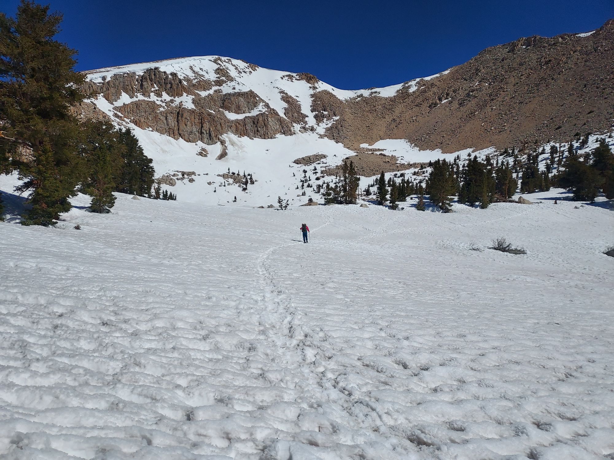
The other issue was the snow itself. The nights up in the mountains were very cold -- I don't think any of them were above freezing. That meant that the snow would freeze after dark, making it relatively okay to walk on in the morning. As the sun started to rise, though, the snow would turn to slush that sucked at our boots, made us slip and slide down hills, and that made sun cups and even worse hazard. (Sun cups are pits in the snow caused by some snow melting faster than the stuff around it -- they make it very easy to twist an ankle.) We also had to worry about postholing, where you punch through the snow to the ground below, potentially hitting your leg or knee on a downed tree or rock hidden underneath.
I'll be honest -- by the time we got to the ranger station, I was considering turning around no mater what they said. I was imagining another month of slow slogging through the snow, and it wasn't appealing. Plus, my feet had been wet for the past two days, since we were getting into camp so late that my shoes and socks didn't have enough time to dry before they froze. (Putting on frozen socks and then frozen shoes now ranks pretty high on the list of things I hate doing.)
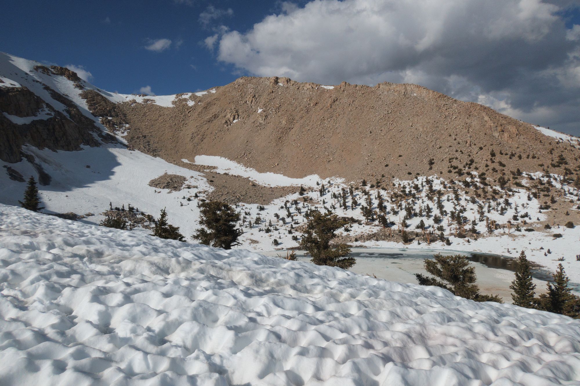
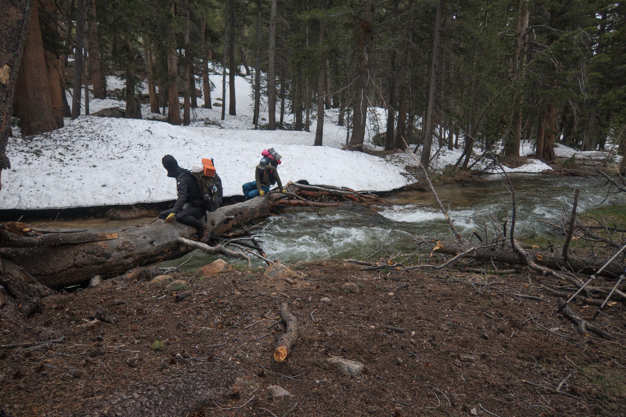
When we got to the ranger station, though, the story hadn't changed. In fact, they told us that the ranger who had originally made the report had gone back up to check if the conditions had improved, and they hadn't. The ranger did offer us one piece of good news, though -- she said that instead of backtracking through the slog we just did to get back to town, we may be able to exit via another trail called the Whitney Portal. Excited at that prospect, we set out for another day and a half of slogging through snow. That journey also added in another of the Sierra's challenges: river crossings. We had to do two, one of which involved shimmying over a log that was perched over a fast and deep creek, while the other required us to take off our boots and wade thigh-deep through some of the coldest water I've touched.
When we finally reached the junction for the Whitney Portal, we met up with some friends that we'd run into several times along the trail. They didn't have good news for us. They'd gone along the trail as part of their climb up Mount Whitney (a common side-quest for PCT hikers that want to see the world from atop the highest peak in the lower 48), and they didn't think it was feasible with full packs. PCT hikers aren't allowed to camp along the Portal, so it seemed like our choice was a 18-20 hour day filled with rock scrambles, difficult traverses, and who knows what else, or going back the way we came. We chose the later.
Even though we ended up backtracking, I'm glad we gave the section a shot. The trudge through the snow was often interrupted by incredibly scenic views, and I learned a lot about traveling through snow. By the last day, I was much better at navigating through the increasingly slushy conditions.
That's not to say that I'd gotten any faster, but I was at least falling and twisting my poor knees less. Hopefully those skills have stuck around through my time off trail, as we're still expecting to hit a lot of snow as we make our way out of South Lake Tahoe. And that snow will probably be all slush, versus the easyish-to-walk-on icy stuff. given the heat wave hitting all of the Sierra (making the river crossings even MORE dangerous as the melting accelerates).
But wait, if we turned around, how'd we end up in South Lake Tahoe? That's around 350 miles up the trail.
Once we got down into Lone Pine again, we regrouped at a place called Hidden Valley Ranch, a beautiful place that lets hikers stay for free and gives them access to showers, laundry, and a way to cook real food. (There's no relation to the dressing brand, though.) There, we decided the best move was to skip the Sierra for now, and come back to it later. It was a tough decision to be sure, but it felt like the right one -- the ranger told us that the several passes after Forester would likely also be pretty dangerous, and rising temperatures meant that rivers would be swelling more, getting even harder to cross safely. Plus, we didn't want to spend all our time in the snow when there's still so much trail left to do.
We spent a day or two figuring out where to go -- we didn't want to skip too much, but also didn't want to just end up in the same conditions again. Eventually, we settled on South Lake Tahoe, and decided we would try to hitchhike the 200-ish miles north. (If that failed, we could fall back on the bus that runs from Lone Pine to Reno, where we could get another bus to Tahoe.)
Yesterday, we strung We strung together five hitches and two bus rides, during which we met some absolutely amazing people. On one of the last rides, I happened to see a blaze for the Tahoe Rim Trail, which goes around Lake Tahoe. I hiked it last year, so it feels a bit like I'm back in familiar territory. Sure, the trail ahead is covered in snow, but I've hiked it before -- and I'm looking forward to hiking it again, especially after spending so much time off trail.
First, though, we have to resupply to make sure we have enough food for the trail ahead. Thankfully, that's much easier and cheaper to do in a big town like South Lake Tahoe than it was in Lone Pine, with its single market. After that, we'll be hitting the trail. This time, I hope the challenges are a bit more manageable!