The Oregon Trail

8/06 - Ashland, OR - Mile 1,720
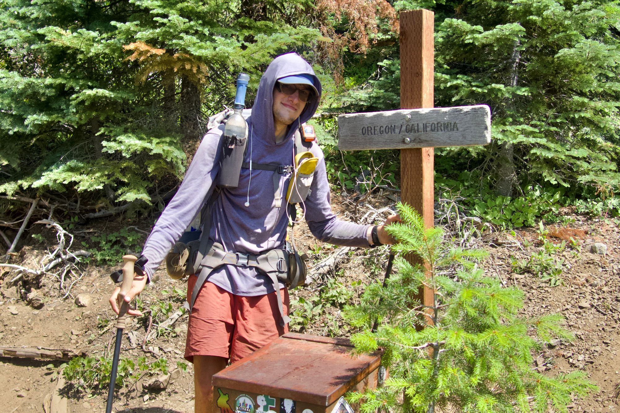
After just over three months, I've finally made it out of California. On Friday, I crossed over into Oregon, the second of three states that the PCT goes through, and – from what I've heard, at least – the one with the easiest hiking.
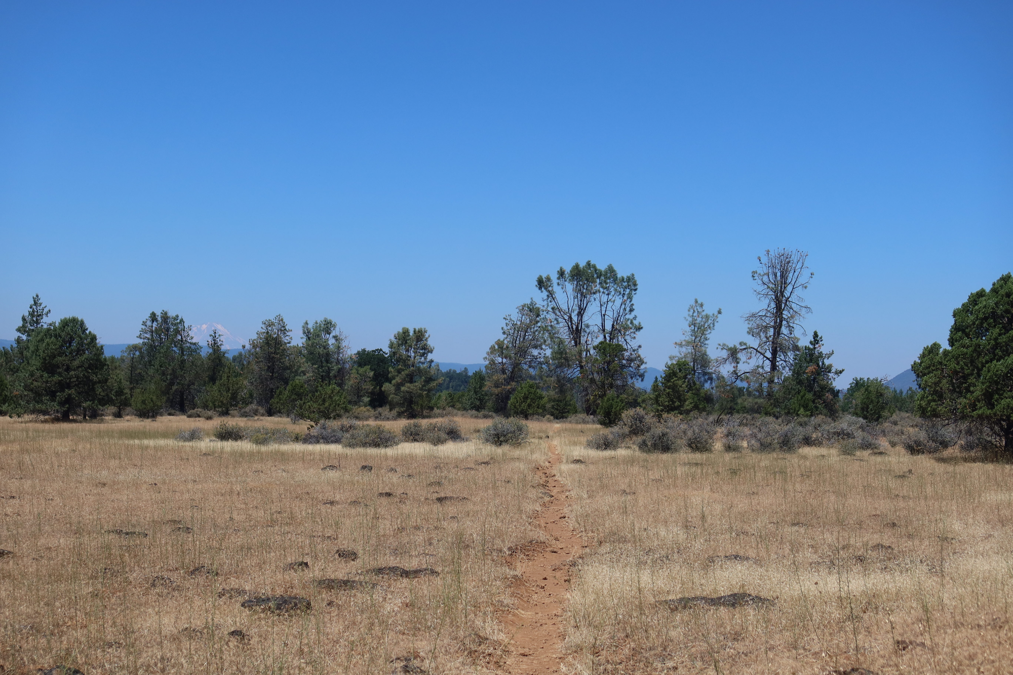
I hope that's true. The northern California section was one of the most physically demanding things I've ever done, for a variety of reasons. First was the heat – there were weeks where every day saw me walking in temperatures over 100°, often with little to no shade (for reasons that we'll touch on in just a moment). Nearly every other hiker I talked to commented something along the lines of "man, can you believe this heatwave?" Locals, meanwhile, said that was just what summer was like these days.
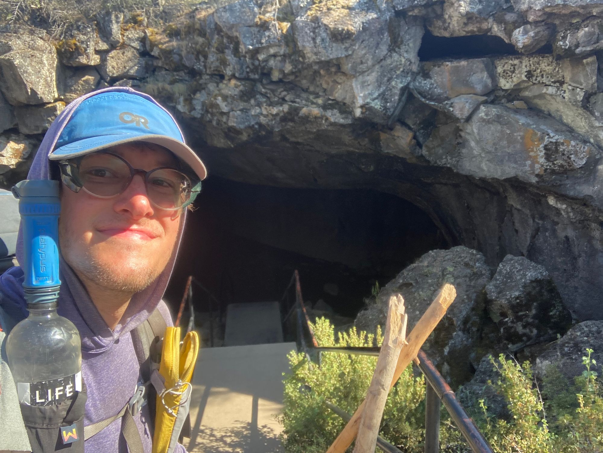
There were occasional moments of relief; rivers and lakes to swim in, or trees to sit under and enjoy some cooling wind. (The most unique respite was Subway Cave, a quarter mile lava tube that you could walk through where the air was a refreshing 50 degrees.)
However, getting to those landmarks was often difficult. The terrain in NorCal was defined by canyons – I spent several days doing knee-crushing descents, going down thousands of feet in elevation to get to a river or town. The days after, of course, were spent climbing thousands of feet back to the crest, often over the course of a dozen or more miles.
NorCal is also defined by burn zones. In recent years, several massive fires have swept through the area, turning a large chunk of the forests the PCT used to travel through to ash. Walking through the charred trees, often for days at a time, doesn't exactly make for beautiful sight-seeing.
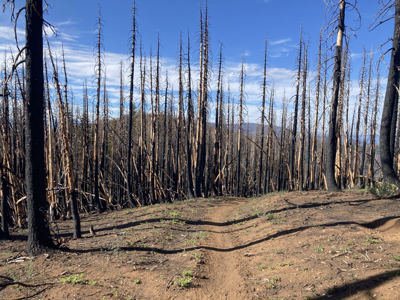
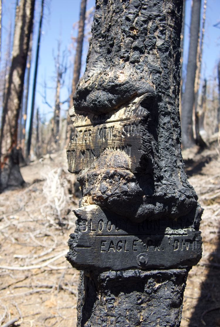
The burn zones pose many challenges beyond just the miserable aesthetics. Dead trees are far more likely to fall over or drop giant limbs than their live counterparts, which makes camping under or around them genuinely dangerous. (The fallen wood is called "deadfall" for good reason.) That can make finding a place to pitch a tent rather difficult – the first time I did 30 miles in a day was because the last 10 were in a burn zone, and I couldn't stop until I found a safe place to camp.
When they're not falling on unsuspecting hikers, the trees sometimes fall over the trail, becoming an obstacle that you have to either climb over or scramble around. I didn't keep an actual count, but I know that I climbed over hundreds of these blowdowns during my time in California's final section.

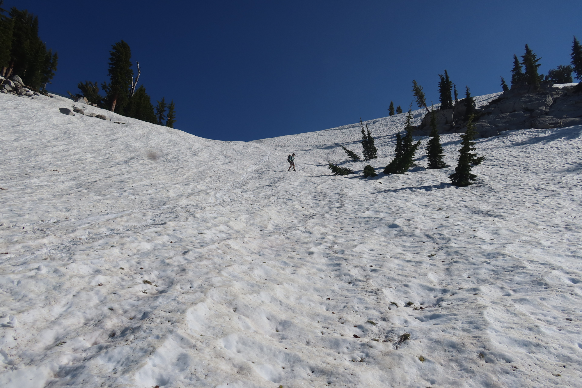
I don't want to give the impression that it's been all bad since I made it to South Lake Tahoe a month ago. (Apologies, by the way, for taking so long to write another of these posts.) There have been some highlights along the way. For one, there were only a few days of snow hiking after South Lake Tahoe, though some of it was the most intense stuff we encountered. Still, knowing that we would soon be out of it made it a somewhat enjoyable challenge at times, like when we had to slowly pick our way down a ski bowl.
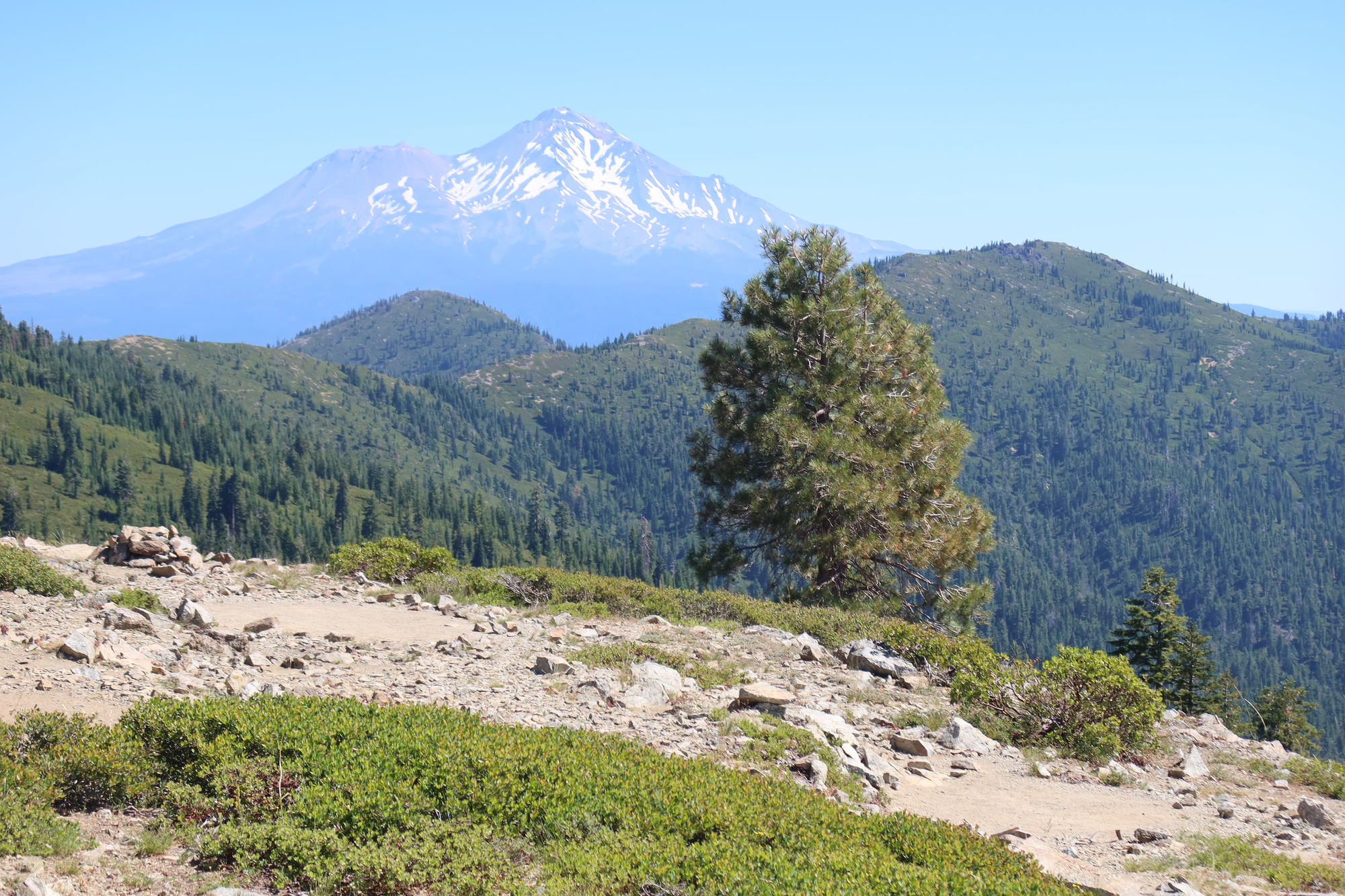
There has also been some goregous scenery dotted among the burned forests and endless same-y climbs. Perhaps the most beautiful was the Castle Crags, a series of spire-shaped rocks that dominated the sky for a few days, sharing the landscape with the stunning Mt. Shasta. (It's nice to be able to just appreciate a mountain, knowing that you wont have to climb it.)
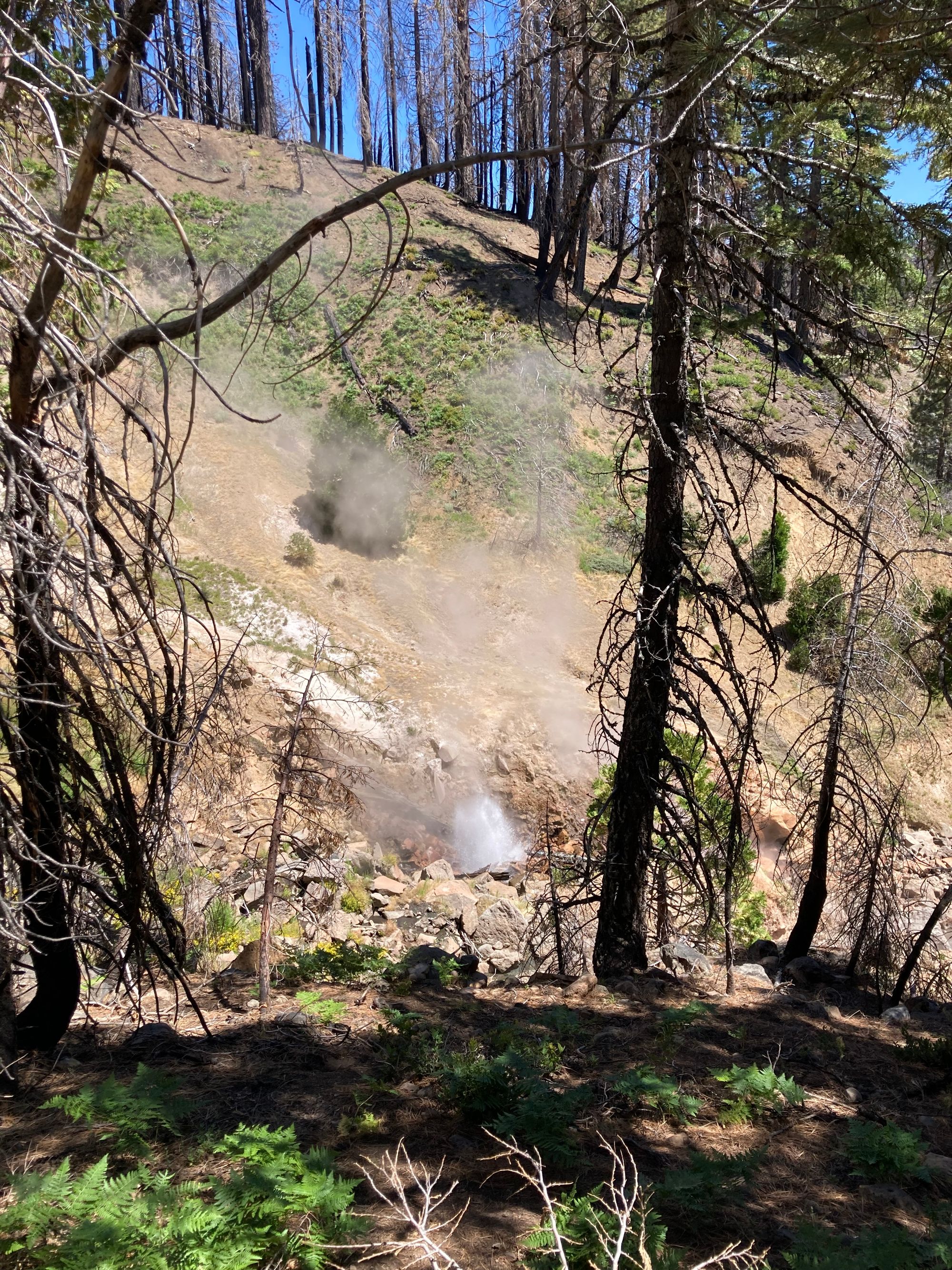
Lassen National Park also stands out – while much of the park was burned, there were side trails that led to geothermal features like Boiling Lake and an extremely active geyser.
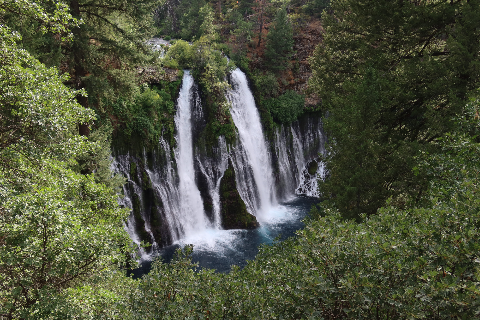
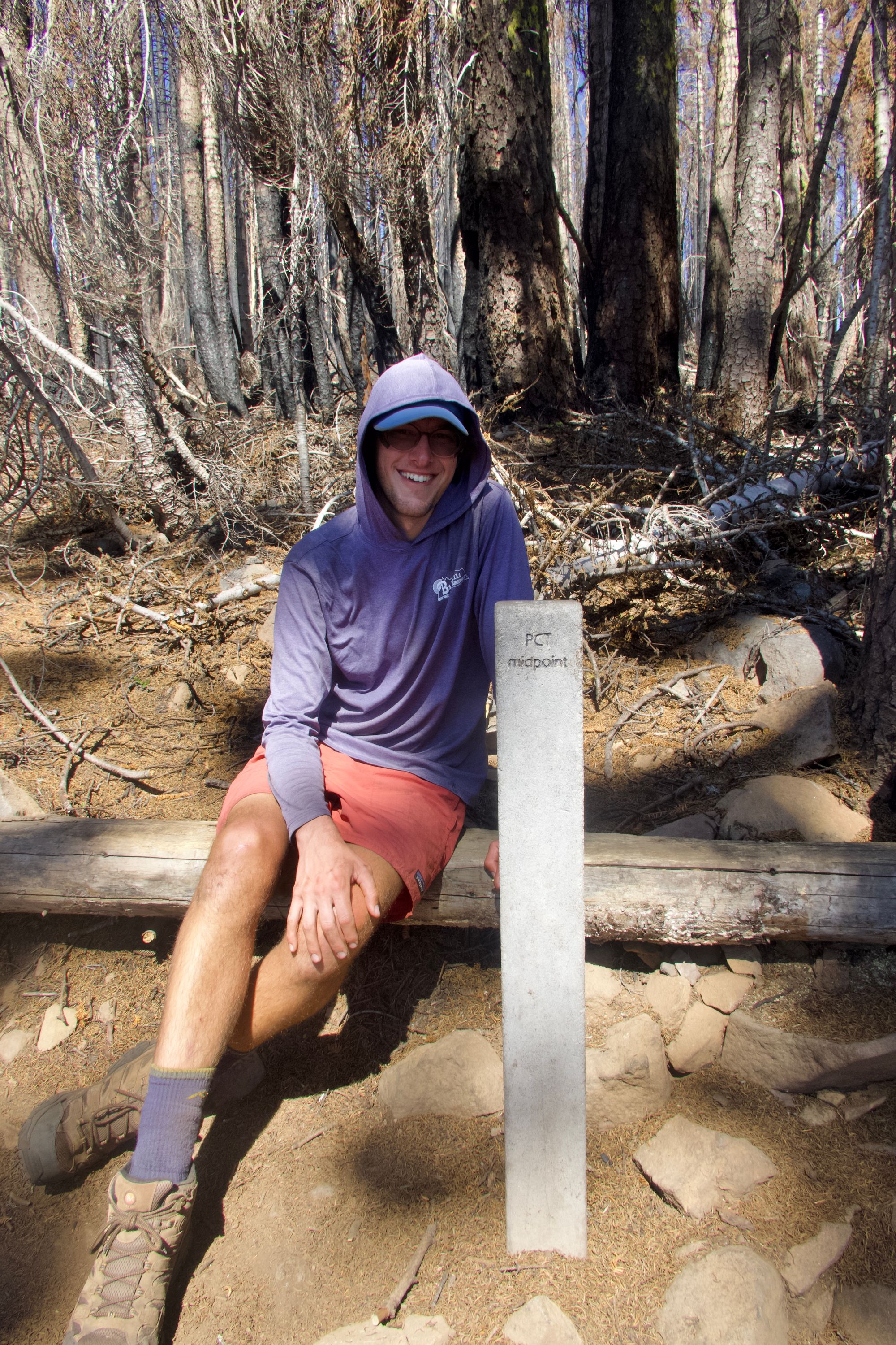
Other highlights include Burney Falls state park, the herds of deer that I've come across (though some of them are clearly FAR too familiar with people), and reaching the halfway point of the trail on July 17th.
The towns throughout the area have also been wonderful; the people are generous in helping out hikers, and there were several places that really seem to understand what hikers need – things like Etna and Sierra City (where I also got to see mom for a day!) that have public showers that you can use without having to rent an entire hotel room or book space at a hostel.
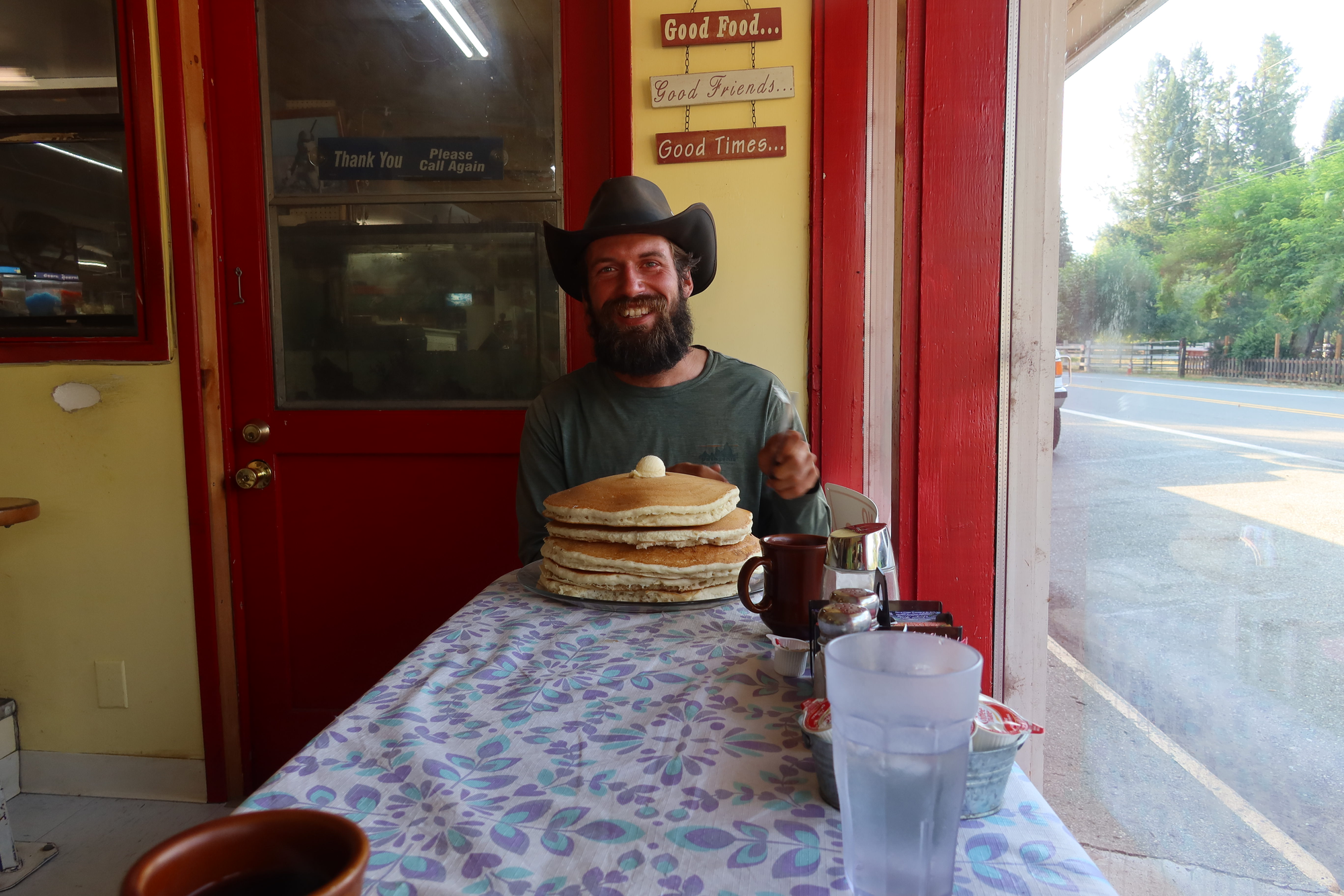
Speaking of those towns, I also got to see not one, but two people attempt the famous Seiad Valley Cafe pancake challenge, where they're given two hours to eat five gigantic pancakes. Only seven people have ever succeeded in the past two decades, and neither were the people I was watching. It was still hillarious to hear the cafe's owner giving her pre-challenge speech, which ended with "the most important rule:" if you throw it up, you clean it up. (Thankfully, both guys quit before their stomaches revolted.)
Now that I'm in Oregon, I'm hoping to pick up the pace quite a bit. The terrain here is a lot flatter compared to NorCal, and I'm looking forward to hiking past landmarks like Crater Lake and Mount Hood. My hope is to finish the trail in early September, but achieving that goal may require a bit of luck – I've still got around 900 miles to go!